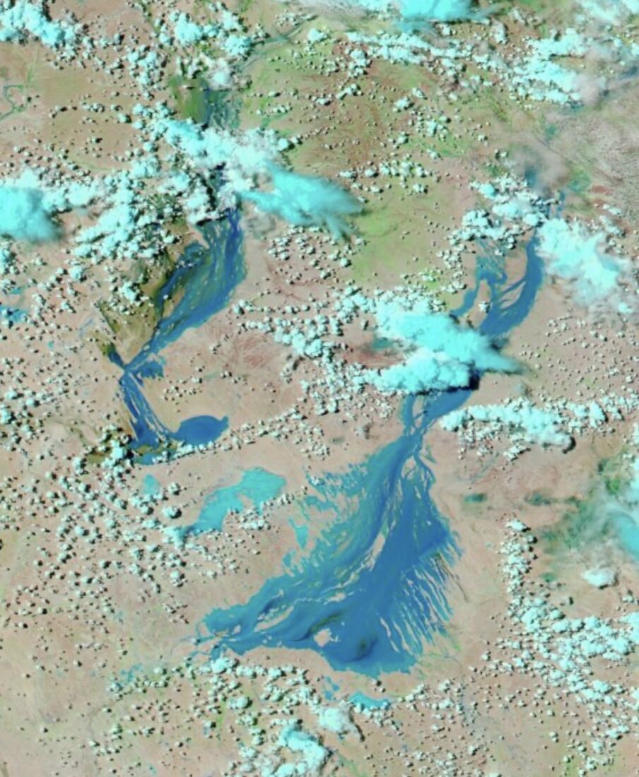
The 2024 Eyre Creek and Diamantina Floods
This page was last updated on Thursday 15th February 2024.
It serves as a record of the flood events of that time. Image above taken during the 2023 floods.
Eyre Creek Flood Status - February 2024:
In 2023 many of you would know that Eyre Creek to the west of Birdsville experienced a major flood that prevented access to Birdsville from the Desert until the 17th of July. For many, this was a major inconvenience which is understandable.
This year, areas of northern QLD have again received significant rainfall. We have been tracking this daily and based on the information we have, we don’t believe the Eyre Creek will flood in the same manner or cut desert access as it did last year.
Some rainfall stats are below and relate to four major Eyre Creek catchment points:
- Camooweal for the period Jan - March 2023 received 578mm. This year to date 302mm.
- Urandangi for the period Jan – March 2023 received 247 mm. This year to date 158mm.
- Carters Bore for the period Jan – March 2023 received 557mm. This year to date 334mm.
- Alexandra for the period Jan – March 2023 received 702mm. This year to date 301mm.
The Eyre Creek catchment is a very specific area and based on all the information we have to hand (rainfall totals, satellite imagery and information from local landholders) we believe floodwaters will reach the Eyre Creek's most westerly point before it turns south but will unlikely prevent the normal QAA Line crossing from being passable.
If minor floodwaters do make it down this far, the northern Eyre Creek bypass route will again be enacted and opened as it was in 2023. If another significant low in the coming 6 weeks was to develop and dump large tallies of rainfall in the catchment area again, things could change. We will provide fortnightly updates and notify of any changes to this situation.
Diamantina River Flood and Eastern Access to Birdsville - February 2024
The Diamantina River catchment this year has received, as widely publicised, some significant rainfall totals in areas.
We have again been tracking this flood event daily and the front-waters reached Birdsville last night. This resulted in the river level rising at the Diamantina bridge to the east of Birdsville from 1.8m to 2.8m this morning (see video). We anticipate the bridge and the causeway to go under water this weekend and become impassable. Floods such as this one generally mean road access to Birdsville from the East & South (Birdsville Track) will be closed for 2 – 4 weeks provided there are no further significant rainfall events in the catchment.
Given this, at this point we don’t expect any access problems from mid-March which coincides when our local authorities generally open the Simpson Desert for traffic and tourism each year. We will provide fortnightly updates regarding the status of this flood along with the Eyre Creek flood.
Some of these floodwaters will inevitably make it to Kati Thanda-Lake Eyre but how much is hard to tell at this point. What we do know is that the local area from Lake Machattie in the north to Goyder Lagoon in the south will be visually spectacular during this flood event and for the remainder of the year as the channel country turns into an oasis of green.
We hope you have found the above information useful in planning your Simpson Desert and Western Queensland adventure and we look forward to welcoming you to Birdsville in the coming months.
Courtney Ellis
Publican - Birdsville Hotel
Video: Diamantina River as at 9am 14th February 2024

