The 2025 Eyre Creek and Diamantina Floods
23rd April 2025: Channel Country and Kati Thanda-Lake Eyre update
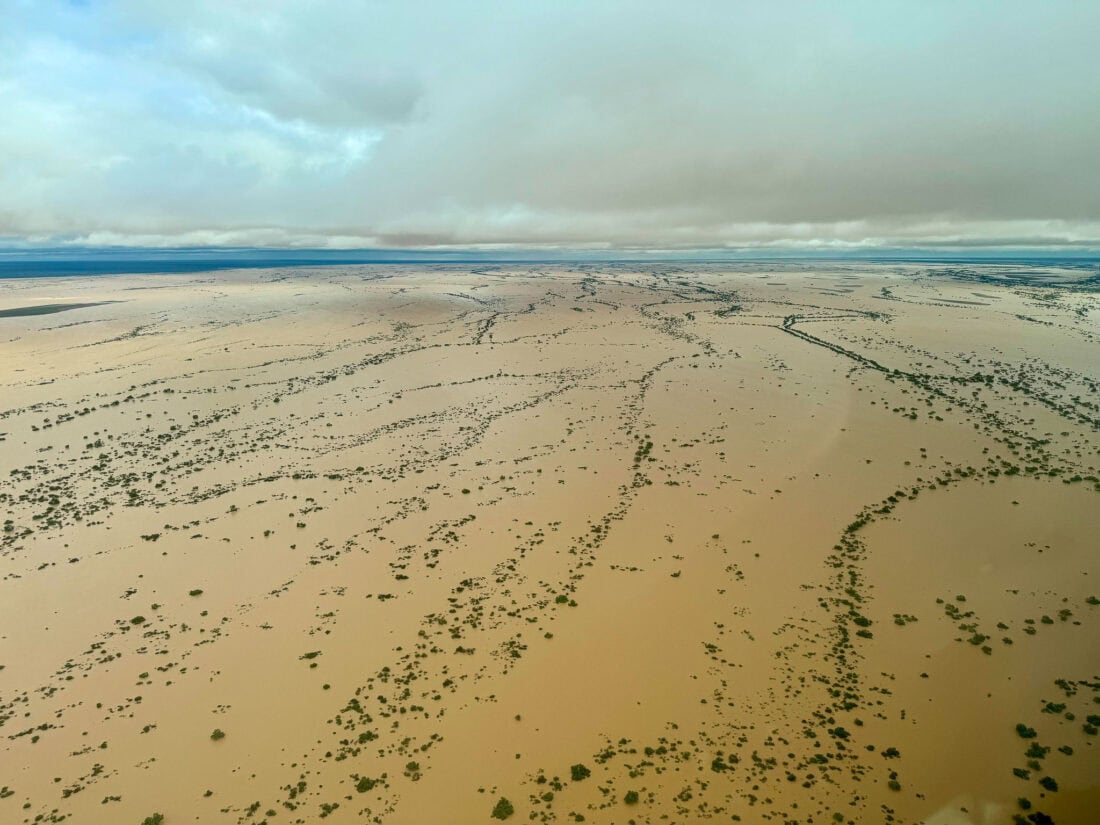
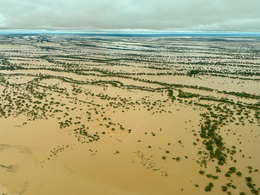
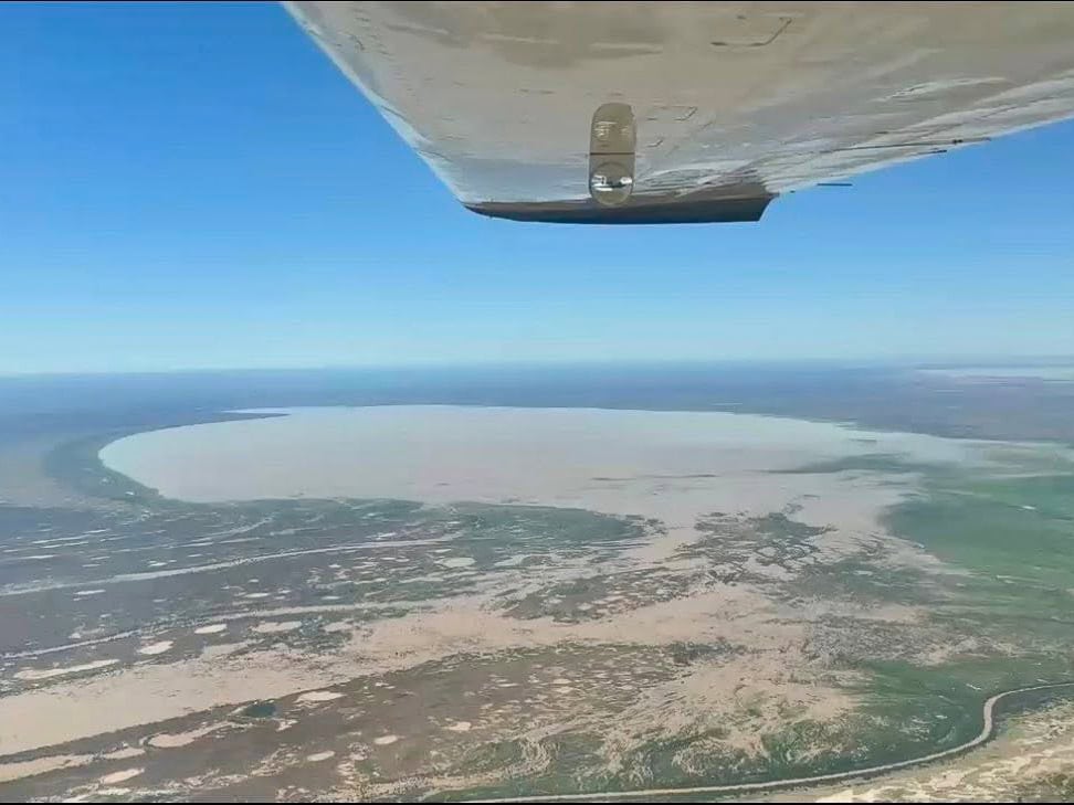
The Channel Country is putting on a show right now! To have all 3 catchment systems in the Kati Thanda-Lake Eyre basin flooding to this extent and in tandem, is an extraordinary event. The Diamantina River has been filling the Goyder Lagoon (pictured below) for weeks and while it will continue to fill for some time, the headwaters have already made considerable progress down the Warburton River towards Kati Thanda-Lake Eyre.
The current Cooper Creek flood is greater than the 1974 flood, arguably similar to the 1950 flood and all this water is also heading for Kati Thanda-Lake Eyre, an end goal that has only been accomplished a handful of times in the last 100 years. The impending filling of Kati Thanda-Lake Eyre this year is set to be truly a once in a generation event. The astonishing amount of water draining out of the channel country is now leaving behind a sea of greenery and blooming wildflowers in its wake. All of this can be experienced from the best vantage point either on one of our many scenic flights departing Birdsville over the Channel Country and Kati Thanda-Lake Eyre or by joining our immersive 5 day Air Tour departing Longreach.

19th April 2025: Channel Country flood update
Eyre Creek/Munga-Thirri Simpson Desert:
After many hours of flying around the Eyre Creek catchment and comparing the flood to prior years we can confirm that there is a lot less water in the system compared to 2023.
In 2023 the Desert was closed from mid May until the 17th July when the Eyre Creek bypass track was opened so people could traverse the Desert in its entirety (Mt Dare - Birdsville or vice versa). This year the opening of the Desert on the eastern side is going to be reassessed in May. It is debatable whether it will be open at this time (up to National Parks and various authorities) but we don’t believe it will be long after given the significantly less floodwater coming down the Eyre Creek system.
Poeppel Corner did receive a large amount of rainfall in late March with the exact amount a little unknown. There is a new automated rain gauge at Poeppel Corner but this was its first reading and its accuracy is questionable. What we can say is that there is a lot of water between the dunes in that area but it is drying up and our guess is that in the coming weeks traffic will be able to skirt around the wet areas to get through. It will mean the journey and the travel time will be longer so it’s recommended more fuel and time needs to be budgeted for, for a Desert crossing.
What’s important is that if you are considering a Munga-Thirri Simpson Desert crossing this year, we can’t see why you wouldn’t be able to, apart from a delayed start. Once we get more clarity on exact opening dates we will of course post them and provide another update.
Diamantina River & Eastern/Southern Access:
The Diamantina flood has peaked at Birdsville and is already receding. Floodwaters are well through Goyder Lagoon and moving quickly towards Kati Thanda-Lake Eyre. Birdsville access from the East is of course still shut and will be closed for at least another 2-3 weeks but an alternative access route from our North East is being prepared by the Boulia and Diamantina Shire councils. We’re not sure when this route will be officially available to the public but we’re hoping to get an Aviation fuel truck through late next week. Again, once a definitive date is decided upon we will of course post it.
5th April 2025: Channel Country flood update
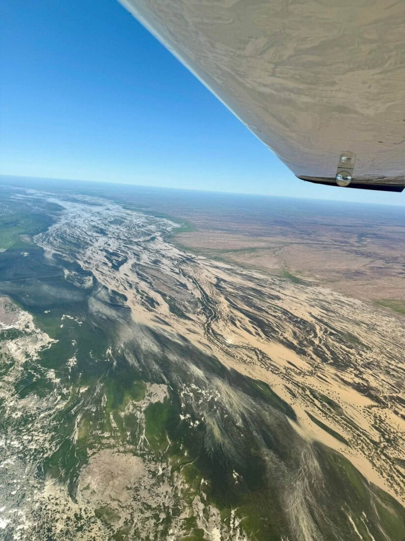
A couple of days ago as the weather around Birdsville cleared, we decided to go for a 3 hour fly around to start getting a handle on what this year’s Eyre Creek and Diamantina catchment floods might mean. In this post we’re focusing on the Diamantina with info on the Eyre Creek flood to come a bit later.
Floods in the Diamantina catchment (a specific catchment area that’s between the Eyre Creek catchment and the Cooper Creek catchment) are by no means unusual but the one upon us is certainly one of the largest we’ve seen for a while. Looking at and comparing satellite images, photos and memory bank info - this flood of 2025 easily surpasses those in 2023, 2022 and 2019. It may also surpass the flood experienced in 2010 and 2011, the larger of the floods so far this century. When flying around there’s always ‘oceans of water’ but this year what stood out was the length of the flood waters. At present it stretches from pretty much the top end of the system near Winton to about 50kms out of Birdsville to the east, as per the short video below which we took when we found the head waters. Time will tell of course but unlike our western QLD neighbours like Thargomindah and many small towns in the Cooper Basin, our township of Birdsville does not go under water or flood. Our hearts and good wishes go out all those who have had their houses, businesses and properties impacted by flood waters.
After the short-term inconvenience of some roads into Birdsville being closed (eastern access from Windorah and southern access via the Birdville track) some exciting times do lay ahead for anyone wishing to visit the Diamantina, Cooper or Eyre Creek regions in Western QLD. The floods in this remarkable channel system are truly phenomenal events and spectacular when viewed from the air.
For those looking to visit later on in the year, it’s our estimate that Birdsville’s eastern and southern access roads, which rely on the bridge over the Diamantina River, will be closed from approximately mid-April to mid-May. It could be longer or shorter and will depend on how quickly the flood waters move through. We monitor things daily and so when we get a more definitive duration of how long our eastern access will be cut, we will of course post an update. Keep an eye on the official road closure advice from both the QLD and SA main roads as well. Access via Bedourie and Boulia, our northern access, is a little more tricky to work out and so more info on this will be posted in the coming days. In short though, we believe it will be the least affected route in and out of Birdsville.
The video and photos were taken by Birdsville Aviation, the Birdsville Hotel Aviation arm, and many scenic flights will be operated in the coming weeks that take in the Eyre Creek system including Lake Machattie and the eastern Simpson Desert (our most popular flight in 2023), the Diamantina River system, Cooper Creek system and Coongie Lakes and of course Kati Thanda-Lake Eyre itself. It will take 6-8 weeks at least for any significant waters to reach Kati Thanda-Lake Eyre so flights down over Goyder Lagoon and down to the lake will be operated when the flood waters do reach this giant inland sea.